Our approach
We publish what our software does and the results it gets, not how it does it. Technical details are presented to partners and cleared evaluators, under a non-disclosure agreement.
-
Position held without GNSS, day and night
Exists (simulation)With the low-cost sensors already on board, the drone holds its position with no satellite and no link. In simulation: a few metres by day, about ten metres at night, where an inertial unit alone drifts by kilometres.
-
GNSS under control
Exists (simulation)The satellite signal is never trusted blindly. Spoofing and jamming are detected in seconds, the position stays held, and every position reaches the autopilot with its confidence level.
-
On-board detection
Exists (simulation)Vehicles and people are spotted on board, day and night, in real time, and scored for confidence. Evaluated on public imagery; to be qualified in flight. Air-to-air drone detection is on the roadmap. Detection informs a human; no autonomous lethal function.
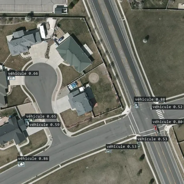
Real detector output on a public test image (“Aerial Vehicle Detection” dataset by small-object-detection, Roboflow Universe, CC BY 4.0). Public image · real output - drone
-
Discretion and link loss
RoadmapNo emission by default. The mission continues without a link, and observations come back without giving the drone’s position away.
-
Logistics and medical, on the customer’s machine
Exists (simulation)Knarr builds the logistic picture and its 24 and 48 hour projections, then proposes a resupply plan; Eira ranks medical evacuation options. Everything runs offline on an ordinary computer, and every decision is validated by an authorised person.
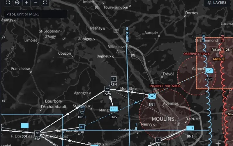
Map of the Decide view: units, flows and threat areas of the fictitious sector. Synthetic data -
Interoperability
RoadmapMAVLink towards autopilots exists. NATO STANAG interfaces towards ground stations and C2 (for example STANAG 4586, STANAG 4609, APP-6 symbology) are on the roadmap.
Data
- Open and synthetic data only: no real military data is used.
- End-to-end flights in software simulation, with an off-the-shelf autopilot.
- Customers operate our software on their own data: we never see it.
What we know and what remains to be proven
Every published figure is a simulation result, obtained under protocols written before the trial and reported as it is, failures included.
No real flight has taken place yet. Phase 0 must prove a night GNSS-free flight at 50 m CEP or better over 5 km, on a partner platform.
Knarr and Eira have not yet been evaluated on a real exercise; that is the goal of phase 1.